|
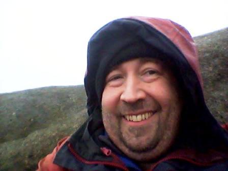
One of the worst ones ever was Kinder Scout on Monday 28th
January 2013. Thawing snow on all the paths and peat bogs made every
single footstep a painstakingly slow, careful and irritating experience. You'd
think that the initial walk from Barber Booth to Upper Booth along tarmac lanes
would be better - but no - black ice everywhere! I was only ten yards into my
walk when it got me the first time and tipped me over onto the road, flat on my
back. The rest of the day kind of followed suit.
I ascended onto the Kinder plateau via Crowden Clough, but this was not
pleasant, especially when that horrible thawing slippery snow was covering the
narrow path right next to the sheer drops on the right! Once beyond Crowden
Tower, most of the snow was nicely consolidated and not taking too much of a
boot - but you could never be sure and from time-to-time, your leg would
disappear. The peat hags appeared to be frozen and good for walking on - and
they were in parts. But in other places they were soft, gluey - and hungry! More
than once I found myself doing a cartoon 'Road Runner' style battle to keep my
feet moving to stop the bog swallowing me whole!
.JPG)
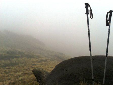
So, onto the plateau, and cue the visibility to disappear and the clag to roll
in. Great. I continued following the general uphill route as I searched for the
spine of the summit plateau, still experiencing physical battles with the
dreadful underfoot conditions every few seconds.
Success - I found my first cairn at the top. I was in the AZ, but wanted to find
Kinder Low before settling down, as visibility was poor, and I knew my descent
route from Kinder Low. Time for a compass bearing. Now my compass had been
smashed in two when I fell on the black ice at Barber Booth, so would the main
part of it still be working properly? No way to find out, it had mysteriously
disappeared, string and all, from my map case.
.JPG)
.JPG)
Now I was in a pickle. I knew where I was, but didn't know what direction was
what, and limited visibility. I could see the next cairn, but didn't know
whether it was east or west! I recalled from the weather forecast that the
predominant wind was going to be westerly, so I progressed by maintaining the
wind on the left cheek of my face! I paused at the cairn with a stick in
it (regular Kinder-hoppers will be familiar with this landmark) and noticed that
the wind was really blowing the mist around. It was causing occasional
improvements in visibility in certain directions. I kept my eyes peeled!
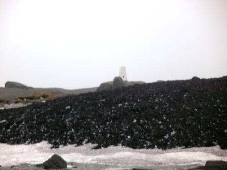
Briefly, came a glance of the trig point and rocks at Kinder Low. And then it
was gone again. But I now knew that walking directly into the wind was
definitely the right strategy. A few minutes later, after more bog and
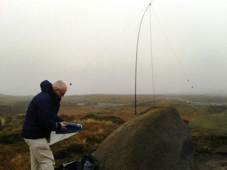
snow hopping, I was there. I began to extend the pole, but soon realised
that this was not feasible in this wind. Sadly, the HB1B and accompanying
80-40-30-20 Band Hopper IV antenna would have to wait.
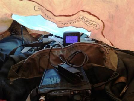
I hunkered down under a large rock for some meagre shelter, and warmed myself up
with some carrot & coriander soup. I glanced at the time on my 'phone. 2.30pm!!!
Nearly five hours taken already! Proof, if proof be needed that the underfoot
conditions were horrible, and that my fitness is well below par. Still
sitting down, I made a call on the VX7R on 2m FM. Immediately, I had a run of 7
or 8 QSOs. No point hanging around then, I really needed to get moving, because
at the speed I was averaging for the day, I might be struggling to be back at
Barber Booth before dark!
The descent down by Edale Rocks was just as arduous and treacherous as the
ascent up Crowden Clough and the peat bogs on the plateau. I prioritised safety
over speed, and so it was painfully slow again. What's more, the rain now came
in, mainly light, but with one 5 minute period of a heavy downpour - lovely.
Once I reached Lee Farm, it was that long and tedious road walk through Upper
Booth Farm and back to Barber Booth.
As I took my rucksack off at the car, there appeared my hitherto missing
compass, still dangling on red string from my mapcase! It must have got caught
up on my rucksack behind me, in my "blind spot"! I finished my soup as I warmed
up in the car, and tried to answer texts from Marianne as to where I was. But I
couldn't - no coverage! Instead, I drove back up over the side of Mam Tor,
pulled in, and sent from there. On 2m FM mobile, my CQ calls were answered by a
G0BUB, and a G3CWI, for a natter on the way home. Definitely up there with
the all-time rubbish, disappointing and soul-destroying activations. BUT I STILL
GOT SEVEN POINTS - YAY!
|
M6OXO |
2m |
FM |
|
2E0LKC |
2m |
FM |
|
G3XMG |
2m |
FM |
|
2E0JCM/M |
2m |
FM |
|
G6ODU |
2m |
FM |
|
MW1ARM |
2m |
FM |
|
G4ZAP |
2m |
FM |
Is this what middle age is? There would
once be a time when a joint activation of G3CWI and M1EYP would include
sometimes both, but usually one of his children, and sometimes one, but
usually both of mine. Fast forward to Sunday 24th November 2013 and all four
of them had either declined the invitation, or weren't even wasted time on
by asking. As I had Sunday dinner with the family planned at the
legendary Weston Balti Raj, I didn't want to go too far, so we agreed on
Kinder Scout for our summit. The initial plan was to park at the Olde Nag's
Head, Edale and climb onto the Kinder plateau via Grindsbrook Clough. We
would then make for the summit ridge and across to Kinder Low, before
descending via the Pennine Way by Edale Rocks, Jacob's Ladder, Lee Farm and
Upper Booth. That was until we found the road out of Chapel-en-le-Frith
towards Blue John Cavern was closed.
Instead, we now drove around the Derbyshire roads until we were on the A624
road from Hayfield to Glossop. Our new intended approach would be on the
path from SK032902 on this road. Opposite this is the turning to
Charlesworth, and on the right hand side of this, around 50 yards from the
junction, is a small rough parking area. The concessionary footpath
was followed in an Easterly direction. It was very muddy and potentially
tricky without the firmness afforded by the cold weather. We were soon
passing the cairn on Burnt Hill, and glancing across to the left wondering
what the white trig point was. (Later research revealed this to be "Harry
Hut", 441m ASL).
The rest of the way to Mill Hill (544m ASL) was on stone flagged paths,
which continued as we merged with the official Pennine Way route ahead of
the steep climb onto the Kinder plateau. The walk continued along the
Pennine Way around the edge of the Kinder plateau until we veered uphill and
away from the edge to attain an operating position well within the
activation zone. Richard was quickest out of the blocks in setting up, so I
found myself another sheltered position about 200m away. The shelter
was necessary, because some unexpected fine rain was now the order of the
next couple of hours. This was a bonus for Richard, who was wanting to test
out the waterproofness of one of his new products. It did mean though that
both of us spent much time inside our respective bothy bags for the
activation.
I indulged in my lunch, which was a flask of Sainsbury chicken noodle soup.
Apprehension surrounded the first sip as I vividly recalled the dreadfulness
of Sainsbury Moroccan chick pea soup from the previous weekend. Thankfully,
this variety was much more agreeable, yet by no means superb. I expect I
will be sticking to Baxters rather than supermarket own brands in future!
After the excellent conditions and results of the previous day, I found
myself disappointed with the 12m band. Richard agreed that conditions were
pretty rubbish, and I made just 18 QSOs in one hour and twenty minutes of
operating. The split was 12 on CW and 3 each on SSB and PSK31. My best DX
was Rich N4EX in Raleigh, North Carolina, USA while the most interesting
contact was arguably Veljo ES0OU on Saaremaa Island IOTA EU-034, worked on
12m PSK31.
A mediocre activation was made worse by the incessant fine drizzle and
increasing wind making it ever more difficult to maintain comfort - and
dryness within the confines of the bothy bag. Furthermore, 3G coverage was
very patchy at best, and non-existent at other times, so self-spotting was a
drag. Therefore I was pleased when I heard Richard's voice telling me he had
finished and was packed up. I wasted little time in packing up myself!
By the time we commenced the return walk, it had stopped raining, and we
were soon enjoying the stroll and improving views. The walk was definitely
the highlight of the day out - the SOTA activation was irritating and
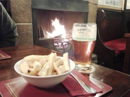
rubbish by comparison! A good pace was maintained, and we were back at the
car by 2.15pm. Plenty of time to call in at the Lantern Pike in Little
Hayfield for a couple of pints of Timothy Taylor's Landlord ale and a bowl
of chips. There were not many recognised SOTA chasers in the log, but
many thanks to those that did manage to work me.
|
UT2LA |
12m |
CW |
|
OH9XX |
12m |
CW |
|
M0JVW |
12m |
SSB |
|
M0MDA |
12m |
SSB |
|
G6LUZ |
12m |
SSB |
|
ES0OU |
12m |
PSK31 |
|
UA1CAS |
12m |
PSK31 |
|
UR8GM |
12m |
PSK31 |
|
9A8W |
12m |
CW |
|
US8UA |
12m |
CW |
|
UA2FCB |
12m |
CW |
|
UA1ZFK |
12m |
CW |
|
E77O |
12m |
CW |
|
G4ZRP |
12m |
CW |
|
N4EX |
12m |
CW |
|
RN1CW |
12m |
CW |
|
UA3DUZ |
12m |
CW |
|
UY5BC |
12m |
CW |
|


.jpg)