.jpg)

|
|
|
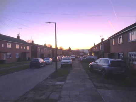
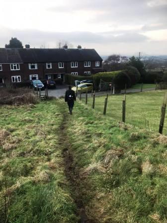
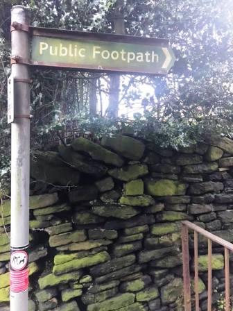
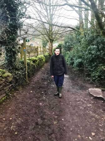
Route description & photos Start anywhere on Merebrook Road (SK11 8RH). Walk to the top of Merebrook Road and out onto Chester Road via Colville Road. Turn right towards Macclesfield. Look out for an opening in the wall on your left. Turn into a path, and then immediately right to walk on a good path more or less parallel to the road. This returns you back onto Chester Road down a few steps. Turn left into the Villas Estate and then right into The Uplands. Look for an open gate on your left leading into the cricket ground.
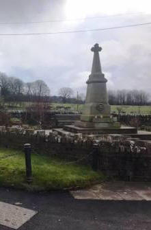
Walk along the path and then car park of the cricket club and exit the main entrance onto Victoria Road. Walk straight over into The Whitfields and head through the residential estate. Turn right into Bittern Grove "The Peanut" and out through an alleyway near its opposite end. Shortly after you emerge from the alleyway, turn right into Wren Close, and then quickly right again into another alleyway. This leads out onto Prestbury Road. Turn right, and then left into Bollinbrook Road. Walk about three-quarters down the length of this road, then turn right through a gateway into the cemetery. Walk across the cemetery to its entrance onto Westminster Road, opposite the Pack Horse Bowling Club.
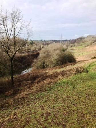
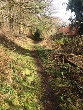
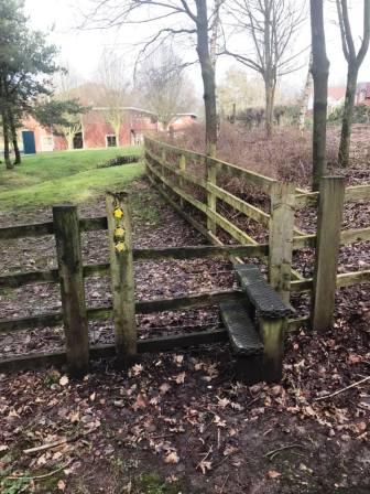
Pass to the left of the Pack Horse Bowling Club along Abbey Road before bearing right to walk down a ramp path into the Bollin Valley. Cross the footbridge and turn right onto the Riverside Park footpath. After passing under the railway viaduct, turn immediately left up a flight of steps to the back corner of Beech Hall independent school. Continue on the footpath high on the right-hand bank of the Bollin Valley. Ignore all the gates on your right until the one that is obviously the "end" - when the path turns sharply left and downhill. Pass through the gate and then continue in a similar direction until the path swings sharp right into Tytherington Wood.
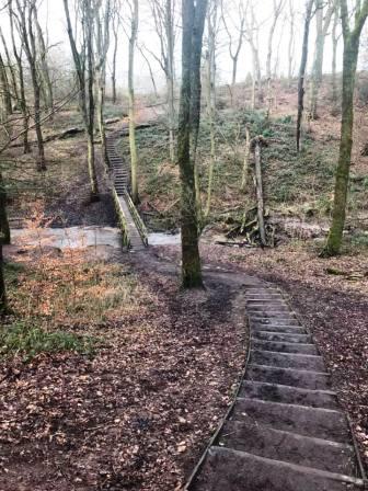
Very shortly, turn left down some steps to cross a wooden footbridge, then climb up the other side of the wood. Turn right onto a good path and follow alongside the wood out onto Dorchester Way. Continue ahead onto another path. There is soon a sharp right, but then just follow the path as it meanders before emerging onto Gleneagles Drive. Bear left and continue straight ahead, up the road and via a footpath to meet the northern part of Dorchester Way. Cross the road and look to turn right onto public footpath that starts opposite the Tytherington Golf Club clubhouse, and runs behind a row of houses.
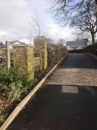
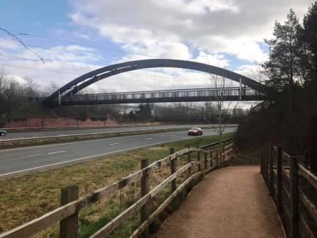
This path comes out onto Manchester Road. Cross over, turn right, and then almost immediately left into Tytherington Lane. Walk down here for a few hundred yards before turning right onto a public footpath into an estate. At the end of this path, look for another that continues down the driveway for Cold Arbour Farm. The footpath weaves its way around, rejoining and crossing the residential road a couple of times. Eventually it follows alongside the main A523 "Silk Road", and then cross a rather impressive footbridge.
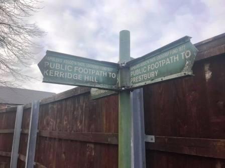
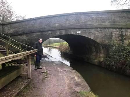
On the other side of the footbridge, bear right off the Middlewood Way to reach the canal at a stone bridge, very close by. Pass over the bridge then continue straight ahead on the track towards Kerridge.
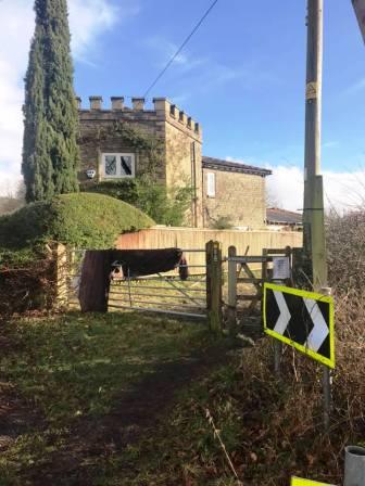
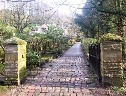
The track bends sharp left before leading out onto a road. Turn right onto the road, which itself then turns sharp left. Stay with the road until the entrance to the driveway to Endon Hall appears on your right. This is also a public footpath, and this is the next part of the route.
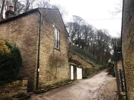
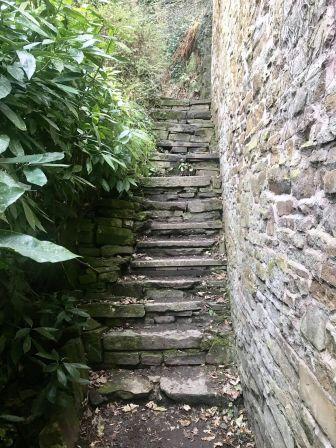
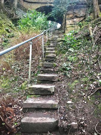
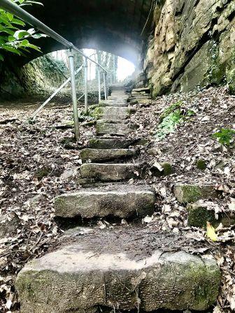
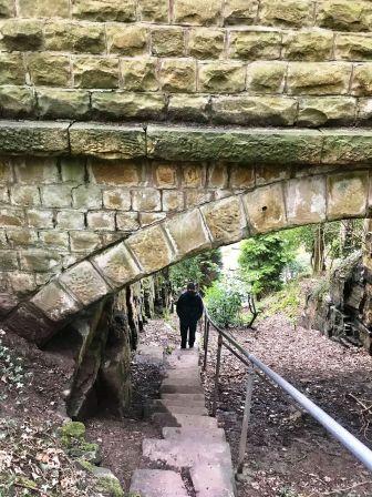
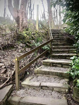
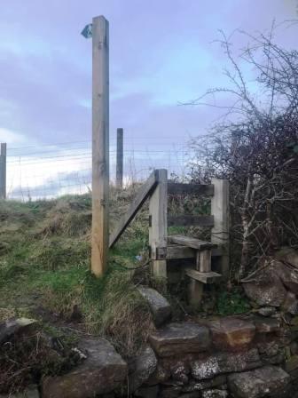
At the end of this track, you come into a small cluster of buildings. Almost directly ahead is a narrow alleyway path with a public footpath sign. This soon turns into a stiff climb up a steep flight of stone steps.
As a child, I was always told this was "Jacob's Ladder" by my father, though I have been unable to unearth any other evidence of that name! The stairway climbs under a viaduct that carries Windmill Lane above, and then the path doubles back to join the road.
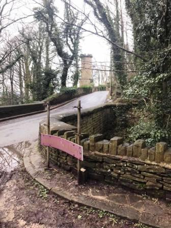
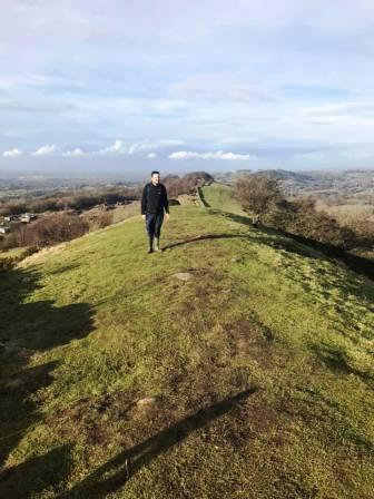
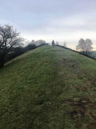
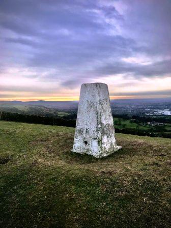
Turn left (south) along the road for a few yards before bearing left up a track, marked by a public footpath sign. This passes some buildings then turns sharp left and heads up more stairs to the ridge. Turn right onto the ridge path and follow all the way up to the trig point at the summit.
Just ahead of the summit, you will enjoy a surprisingly narrow (about 2 to 3 metres, so not too scary for those without a head for heights) section of ridge. Who'd have imagined that in Cheshire? Make sure you stay on the ridgeline and avoid the numerous other public footpaths veering off in various directions.
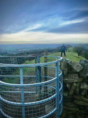
After passing the summit, the top path drops down the other side of the ridge towards Rainow. This particular path doesn't head into that village though, bringing you out onto the B5470 (Macclesfield to Whaley Bridge) road at Kerridge-end. Turn right to walk a short way down the road. A footpath on the left connects up to Tegg's Nose via Bull Hill Lane, and appears in other Lockdown routes on this website.
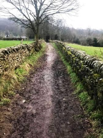
Bear left into Calrofold Lane. This affords more pleasant walking than the mile or so back down the main road to the start-finish point. Look for a public footpath on the right leading through the yard at Chante Cliff. The footpath exits the yard through a new wooden gate, then contours around the north of Cliff Hill.
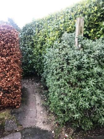
When the footpath first reaches a road, it almost immediately leaves it to head right into another field. This drops down to a row of houses, at which point look for a narrow path between two hedges. This leads down through a long ginnel to Hurdsfield Road. Turn left and walk down the road before turning left into Roewood Lane.
Turn left again into Hillside Drive, and left again into Spring Hill. Turn right into Bibby's Lane, which is signposted as a bridleway.
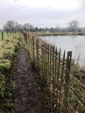
Follow the bridleway in a consistently southerly direction down to Higher Fence. Look for a public footpath sign pointing down a flight of stairs on your right. Descend these, and follow a pleasant path between a wall and a metal fence, beside two reservoirs at Lark Hall.
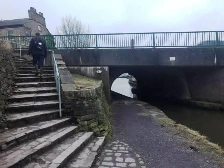
The path ends at Higher Fence Road, which is very roughly surfaced at this point. Turn right towards the canal bridge.
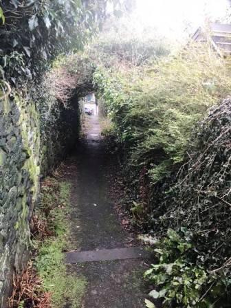
At the bridge, join the canal and turn left to follow the towpath underneath it in an initially southerly direction. Continue just until the next bridge on Buxton Road, and turn right down the hill towards the town centre. Almost immediately, look for an alleyway on your right. Follow this until you reach the second road (Lime Grove), onto which you turn left and follow down to Fence Avenue.
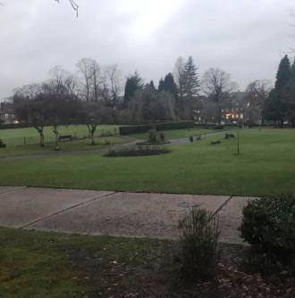
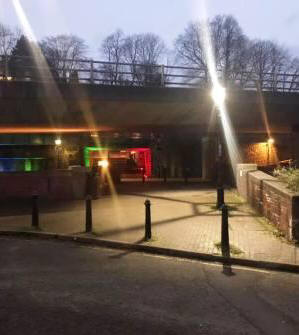
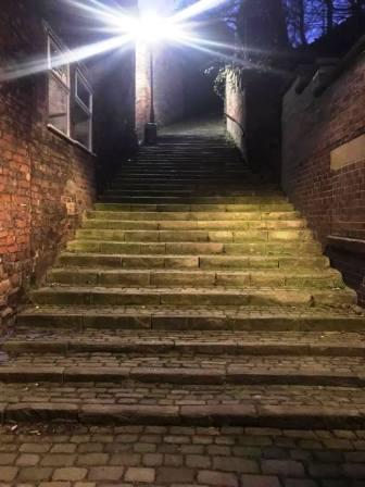
Cross Fence Avenue and walk straight into and across Victoria Park. Maintain a straightish line towards the famous Arighi Bianchi furniture shop. At the front of the shop, walk underneath the Silk Road flyover and railway line (and over the River Bollin), then bear left into Waters Green. Ignore Brunswick Hill and Step Hill on your right (although both would be viable routes at this stage) and continue walking until the Nags Head pub. Beside the pub is the bottom of the famous "108 Steps". Climb these into Macclesfield's Market Place, where you will find plenty of coffee shops and bakeries for refreshements. From here head down Chestergate and Chester Road back to your start point on the Weston.
|
|
|