|
Sunday 17th April 2011 was confirmed as a SOTA day out for Jimmy and myself,
so we were back on the roads west out of Macclesfield at 5.50am BST. Good
progress saw us arrive in Bala at 7.35am. Too good progress - none of the
breakfast options were open until 8am, including the supermarkets. Instead, we
sat and waited. Two large cooked breakfasts and mugs of tea were worth the
wait, and we enjoyed being able to drive all the way to the parking spot for our
target hill, unimpeded by snow and ice. We parked in the area at SH946273, 500m
ASL, opposite the start of the track. This was to be a long walk!

.JPG)
I was carrying my new Vango 60 litre rucksack. My old Berghaus pack had been
used to death, and too many of its features were now not working properly. The
Vango had a better design for everything I want to do and carry, although I
hadn't quite got all the adjustments yet right. We were also carrying new
bladders in our rucksacks. The new ones had a much better design with
turn-to-open/close bite-valves and bite valve covers and a improved way of
opening/closing the reservoir.
.JPG)
.JPG)
Once the track had climbed the angled bank from the road, it turned Eastwards
for an undulating meander towards the summit. After an intermediate highpoint of
640m on the shoulder of Pen y Boncyn Trefailw, the track turned ESE for a series
of long curving descents, as far down as 570m ASL. But that heralded the final
ascent to the highest point of the track at SH988284, where we turned right (SE)
on a narrow path through the heather to the fence. Here we turned right again,
following the fence through bog and peat groughs to a junction of fences where
we turned left (south) to the summit cairn.
.JPG)
.JPG)
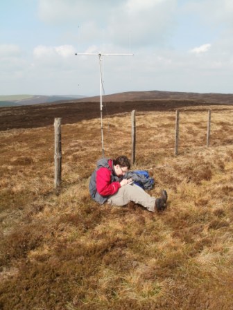
It was 2m FM for Jimmy MW3EYP/P and 20m CW for myself MW1EYP/P. Jimmy managed
just the requisite four QSOs to qualify his activation, while I had a similarly
mediocre total of six. Not even offering the WFF reference of GWFF-074 sparked
any additional interest, so we packed away and braced ourselves for the long
haul back to the car on this warm sunny midday.
.JPG)
.JPG)
We reached the car by around 2.20pm. I was going slowly due to a combination of
sleep deprivation (only four hours managed the previous night), tiredness and
side pain as I struggled to find the best adjustments of my new rucksack. During
the walk, we each worked new activator Rufus MW6MGB/P using our 2m FM handhelds.
Rufus was activating Penycloddiau GW/NW-054.
At the car, we checked out the road atlas and the OS Explorer maps we had with
us. I decided that we were about an hour too late to consider activating
Esgeiriau Gwynion GW/NW-031, which otherwise may have been our first choice.
Other options were mooted, such as Penycloddiau GW/NW-054,
Mynydd y Cwm GW/NW-076,
Foel Goch GW/NW-039 and
Hope Mountain GW/NW-062. But ultimately Jimmy convinced me to take on
another new unique, in the form of Mynydd
Cwmcelli GW/NW-052. Thanks to all the stations that we worked:
|
G1OPV/P on Pendle
Hill SP-005 |
2m |
FM |
J |
|
2E0NVJ |
2m |
FM |
J |
|
G6ODU |
2m |
FM |
J |
|
G4ELZ |
20m |
CW |
T |
|
OK1CZ |
20m |
CW |
T |
|
DL6KVA |
20m |
CW |
T |
|
G4SSH |
20m |
CW |
T |
|
EA3EGB |
20m |
CW |
T |
|
S57EA |
20m |
CW |
T |
|
G0HRT |
2m |
FM |
J |
|
